
GEOSYSTEMS Polska was founded in June 1995. Our work areas are related to spatial information in general, data acquisition technologies, processing, analysis and presentation. We conduct research and development and implementation work in such fields as remote sensing, photogrammetry and geographic information systems. We also engage in knowledge and technology promotion. Together firm the Aqurat Ltd company, GEOSYSTEMS is successfully developing AutoMapa® since 2003 – the most popular in Poland automotive navigation system. In cooperation with Indigo Ltd. the company is also developing the web map portal Targeo®. We are the producer of spatial data supporting these solutions and specialized products profiled for environmental monitoring usage. Since its founding the company is a software provider for image data analysis and processing. The traditional areas for the proposed applications, meaning remote sensing and photogrammetry, are currently complemented by institution offers, which include cataloging and websharing of all spatial data, as well as web-based collaboration using this information. GEOSYSTEMS Polska offers photogrammetry remote sensing software and GIS: Intergraph® ERDAS, Trimble® eCognition.
- AutoMapa – an automotive GPS navigation system which includes 3D building renderings, complete road network and addresses linked to actual buildings. It was the first one in Poland to introduce AutoMapa Traffic, a traffic jam and sudden road obstruction avoiding system.
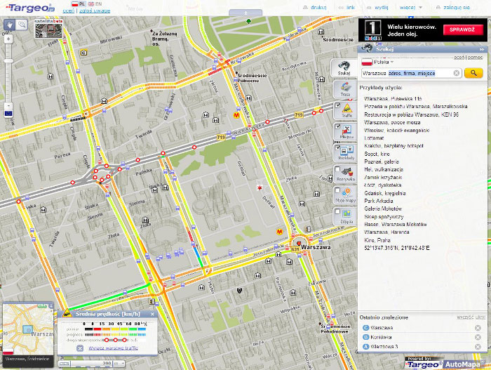
- Targeo.pl – is the third most visited Polish map website by Polish users. It is based on the maps of GEOSYSTEMS Polska.
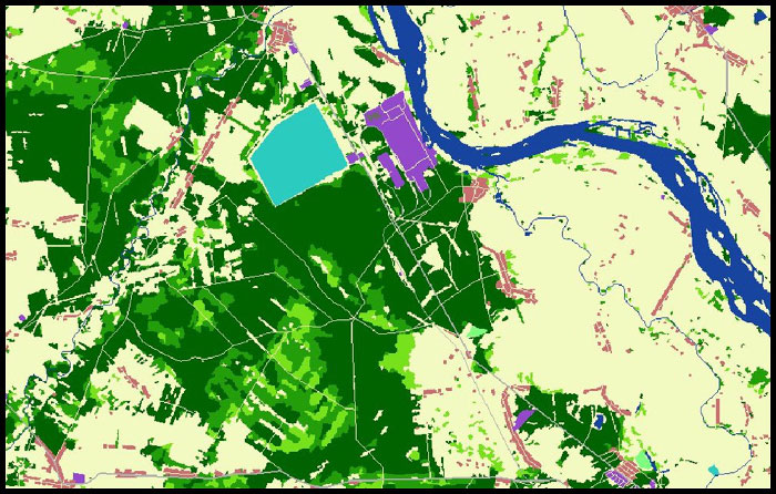
- Spatial information databases – are the most complete and up-to-date collection of spatial information databases for the country. They were created in 2002 and since then were supplemented and updated on the basis of many sources, starting from satellite images to site surveys.
- Software – the solutions offered by the company include tools well known to specialists in such areas as remote sensing, photogrammetry or WebGIS.
AREAS OF ACTIVITY IN THE SPACE SECTOR:
- Applications based on data from EO satellites
- Applications based on data from navigation satellites
MAIN SPACE PROJECTS:
Creating land coverage and terrain usage maps based on Earth observation satellite data: a database covering the full country done three times used in commercial applications.
Participation to the first PECS program edition. The project was: „Forest Monitoring Inputs for National Greenhouse Gas (GHG) Reporting” The innovation lies in the usage of advanced methods of environmental studies based on satellite and flight images and their integration with in-situ obtained data.
RESEARCH AND DEVELOPMENT AREAS:
- Remote sensing applications and satellite photogrammetry
- Data joining from many sources
- Geographic information systems
LABORATORIES AND TECHNICAL FACILITIES:
- A few dozen of work stations and servers
- GIS software, remote sensing, webGIS
CLIENTS AND PARTNERS:
- Aqurat Ltd.
- Indigo Ltd.
- Intergraph®
- Trimble®


