


SATIM Monitoring Satelitarny Ltd. is a spin-off company at the University of Science and Technology (AGH) in Cracow. The company founders are working at the Department of Geoinformatics and Applied Informatics at AGH and the InnoAGH Ltd. Cracow Center of Innovative Technologies.
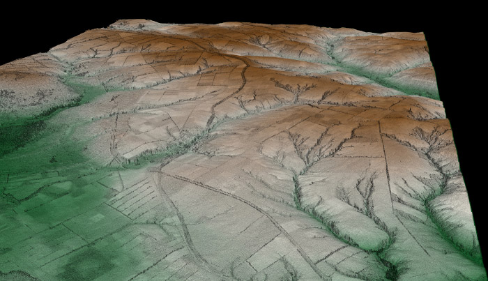
- Satellite and air monitoring of natural hazards such as landslides, vertical crustal motion, floods
- Satellite and air monitoring of vertical terrain motions related to human activities
- Research of surface infrastructure stability such as buildings, roads, dams, bridges
- Satellite and air monitoring of land use and biomass changes
- Satellite and air data purchase mediation
- GIS data analysis
- Creating and managing spatial information databases
- Geoportal production
The SATIM founders investigate in their research the development and application of satellite and aerial radar and optical imagery processing. They have extensive experience in scientific and commercial projects, both national and international in scope. The cooperated among others with EADS Astrium, the biggest European supplier of specialist systems and space industry services. They also took part in the international EnerGEO project, funded within the Seventh Framework Programme of the European Union. Currently they cooperate among others with the European Space Agency within a PECS project.
SATIM is the first company in Poland to use satellite and aerial imagery (radar and optical ones) for so many environmental applications. The company workers have the essential knowledge and experience to conduct sophisticated analyses on: natural disasters, the impact of mining on the environment, changes in land use, city growth, building and infrastructure stability or road deformations. The SATIM company uses remote-sensing data processing using both classical algorithms and their improved versions, developed by SATIM employees.
AREAS OF ACTIVITY IN THE SPACE SECTOR:
- Applications using data obtained by observation satellites
- Integrated applications
MAIN SPACE PROJECTS:
The „Pattern recognition-based decomposition method for quad-polarimetric SAR data” a project within the PECS (Plan for European Cooperating States) program.
RESEARCH AND DEVELOPMENT AREAS:
Development of processing and analysis methods of satellite radar imagery (including polarimetric imagery). Development of available applications of satellite radar imagery (including polarimetric imagery).
ESA PROJECTS:
- Improvement of ground deformations monitoring within urban areas based on dual-pol SAR data in Warsaw city
- Pattern recognition-based decomposition method for quad-polarimetric sar data
- MineSAR – the highly automated software for monitoring mining-induced ground deformations within large areas
- Development of a polsarpro functionalities by implementing new data processing and visualization methods
- Innovative EO-based products for oil and gas sector
- Development of an innovative software called SATREC for identification of objects on satellite SAR imagery by modelling and recognition of radar signatures.
CLIENTS AND PARTNERS: - European Space Agency
- State Mining Authority
- AGH University of Science and Technology in Cracow


